After a bumpy start in the South this week, the holiday travel weather isn’t looking so bad.
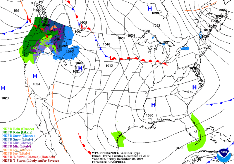
This is the forecast for Wednesday December 18, 2019 thru Friday December 20. We will update again Friday morning for through Christmas.
Air flight Delay map and travel delay map will also post Friday for the whole holiday season.
All forecasts are from the National Weather Service and are for the whole country.
Be safe and enjoy the Christmas holiday.
Short Range Forecast Discussion NWS Weather Prediction Center College Park MD 258 PM EST Tue Dec 17 2019 Valid 00Z Wed Dec 18 2019 – 00Z Fri Dec 20 2019 …
Winter weather spreading from the Ohio Valley into New England today… …Arctic air expected to surge across the Northern Plains toward New England, while mild temperatures spread eastward from the lee of the northern and central Rockies… …High winds likely from Santa Ana conditions across southern California through tonight…
Much of the Northeast and portions of the Mid-Atlantic region continue to have periods of snow and/or a wintry mix this afternoon as the surface low pressure system and associated cold front moves offshore the East Coast. Snow is expected across the interior sections while freezing rain will be the primary threat for southern New England. As it continues to track further offshore, the snow will remain over New England through the overnight hours while tapering off elsewhere.
Along the trailing front and in the warm sector, lines of strong to severe thunderstorms will continue to track through the Southeast and the Carolinas this evening. An Arctic blast will infiltrate the Northern Plains, Great Lakes and New England regions in the wake of the East Coast storm. Sub-zero temperatures are forecast for the upper Midwest Wednesday morning; single digits by Thursday morning for northern New England. These temperatures are 15 to 25 degrees below average.With the stark temperature difference between the warm open waters of the Great Lakes and the frigid air above, lake-effect snow squalls are likely, resulting in locally heavy amounts.
For the West, downslope/Chinook winds will spread eastward from the lee of the Northern Rockies and across the Northern High Plains then southward into the lee of the central Rockies and across the central Plains Wednesday. As such, this will support temperatures well above average across parts of the Northern and Central Plains through midweek. Further south and west, strong Santa Ana wind conditions will persist across southern California this evening. Wing gusts as high as 55 mph may occur, which could cause downed trees and power lines, along with an increased fire weather threat. These Santa Ana wind conditions will diminish significantly by Wednesday as an area of low pressure moves toward northern California. Rain is possible across northern California with this low on Wednesday, but amounts are not expected to be heavy. However, there is an increasing signal that coastal areas of the Pacific Northwest will be wet, with excessive amounts of rain possible.


