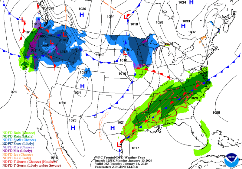
After a long weekend of storms, a Southern Soaker is setting up over already saturated ground.
Amounts of 1″ in Nashville to 2″-3″ for areas like Birmingham, Raleigh, and Atlanta will cause issues all the way through Saturday before we get a break to dry out.
The current low front will bring the following through Wednesday according to NWS:
“A frontal boundary will become quasi-stationary from the Mid-Atlantic Coast stretch southwest across parts of the Tennessee Valley and into the Western Gulf Coast. Scattered showers and thunderstorms will form along the front and could lead to localized areas of flash flooding. Some thunderstorms could also be severe over parts of the Tennessee Valley and Lower Mississippi Valley. Unseasonably mild temperatures will continue across the Southeastern U.S. in wake of the big weekend storm system. Record warm daily high and low temperatures will be possible in parts of the Southeast through Wednesday.”
By Thursday this front will start to move out, and be replaced by another soaker almost immediately. That will finally move out Saturday late evening and Sunday looks good at this point for most of the South.
There isn’t a huge fear of severe weather, but flash and regionalized flooding is a concern. Monitor local weather for updates.


