From the NWS
Short Range Forecast Discussion NWS Weather Prediction Center College Park MD 259 PM EST Mon Dec 23 2019 Valid 00Z Tue Dec 24 2019 – 00Z Thu Dec 26 2019 …
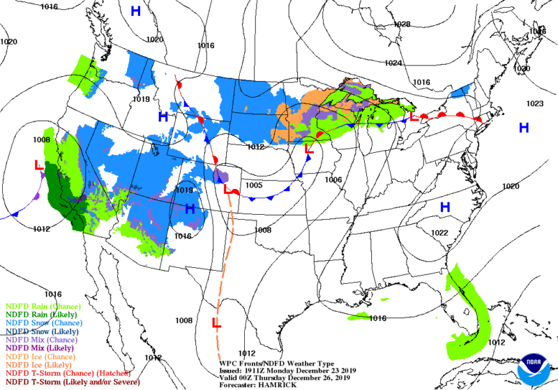
Rain for the West Coast and Southeast U.S., and mainly dry elsewhere…
A strong low pressure system near the Southeast U.S. coast continues to produce heavy rain across the Carolinas Monday afternoon, with the heaviest rain near the South Carolina Coast. Additional rainfall of 1 to 2 inches is likely before the storm moves farther offshore on Tuesday. Given the rain that has already fallen across this region earlier today and on Sunday, flooding will continue to be a problem for poor drainage areas through Monday night. Conditions will improve by Christmas Eve and dry conditions for the entire East coast region for Christmas day.
The second area of disturbed weather will be across the southwestern U.S. through Tuesday as a Pacific front and plume of moisture move inland across this region, with up to an inch of rain for the lower elevations of central Arizona, and lighter precipitation is expected across the remainder of the Great Basin as the front continues to progress east.
Snow is likely for the highest elevations of northern Arizona and extending northward into Utah and Colorado.
In terms of temperatures, most of the nation is expected to be near to above average over the next couple of days, with the greatest anomalies over the central Plains and Midwest with highs up to 20 degrees above average. Slightly below average temperatures return to the West Coast behind the cold front. Dry weather is forecast to continue from the High Plains to the Mid-Atlantic and Northeast states.


