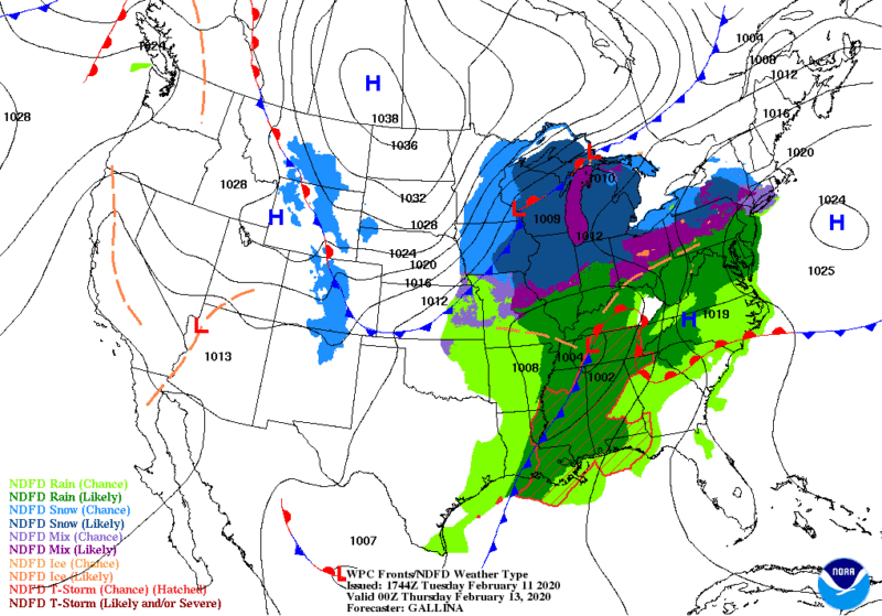
Things are getting bad in Alabama and Mississippi , and are about to get worse for Tennessee and Georgia.
Another round of severe storms and heavy rain is predicted to move in late this evening through Thursday before a drying out period begins over the weekend.
Highlights:
- Rising lake levels are again threatening the Oktibbeha County Lake Dam in Mississippi.
- A levee breach nearly flooded homes in Carthage, Mississippi.
- In Alabama, flood warnings were issued for the Flint River near Chase and at Brownsboro in Madison County, Big Nance Creek at Courtland in Lawrence County, Paint Rock River near Woodville affecting Jackson, Madison and Marshall counties, the Tennessee River at Florence affecting Colbert and Lauderdale counties, and the Tennessee River at Whitesburg affecting Madison, Marshall and Morgan counties
- U.S. 441 between Gatlinburg and Pigeon Forge, Tennessee, had to be closed
- Life Threatening flash floods are predicted with the next storm system
- Severe Storms and Tornadoes are possible Wednesday-Wednesday night
- Another 2″-3″ of rain are expected with the next system.
From the NWS:
A sprawling frontal boundary slowly moves eastward, pooling Gulf moisture from the Gulf of Mexico will fuel nearly continuous convection over this region. This environment will also be conducive for periods of moderate to heavy rainfall, especially over areas that have had several inches of rain in the past 1-2 weeks. With soils near saturation and more rain on the way, widespread flooding concerns will persist across the Gulf states and into the Appalachian region.
This aforementioned system will be responsible for the next round of heavy rain across the Lower Mississippi and Tennessee valleys on Wednesday. Additional rainfall amounts of 1 to 3 inches will be possible from northeast Texas to western Tennessee. Flash flooding will be a concern here once again due to the saturated ground and swollen streams/rivers.
Residents should monitor local stations for up to minute reports.


