LIVE Stream Camera coverage from Houston and Galveston
Ok y’all….if you aren’t hunkered down by now…you are in trouble..be safe..god bless..we will be back tomorrow morning by 7:00 a.m. CST to update..otherwise use our streaming videos to keep informed
BULLETIN
Hurricane Laura Advisory Number  29
NWS National Hurricane Center Miami FL       AL132020
1000 PM CDT Wed Aug 26 2020

...EXTREMELY DANGEROUS HURRICANE LAURA CLOSING IN ON THE NORTHWEST
GULF COAST...
...CATASTROPHIC STORM SURGE, EXTREME WINDS, AND FLASH FLOODING
EXPECTED TONIGHT AND EARLY THURSDAY...


SUMMARY OF 1000 PM CDT...0300 UTC...INFORMATION
-----------------------------------------------
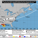
LOCATION...29.0N 93.2W
ABOUT 75 MI...120 KM S OF LAKE CHARLES LOUISIANA
ABOUT 75 MI...120 KM SE OF PORT ARTHUR TEXAS
MAXIMUM SUSTAINED WINDS...150 MPH...240 KM/H
PRESENT MOVEMENT...NNW OR 340 DEGREES AT 15 MPH...24 KM/H
MINIMUM CENTRAL PRESSURE...939 MB...27.73 INCHES


WATCHES AND WARNINGS
--------------------
CHANGES WITH THIS ADVISORY:

None.

SUMMARY OF WATCHES AND WARNINGS IN EFFECT:

A Storm Surge Warning is in effect for...
* Freeport Texas to the Mouth of the Mississippi River

A Hurricane Warning is in effect for...
* San Luis Pass Texas to Intracoastal City Louisiana

A Tropical Storm Warning is in effect for...
* Sargent Texas to San Luis Pass
* East of Intracoastal City Louisiana to the Mouth of the
Mississippi River

A Hurricane Watch is in effect for...
* East of Intracoastal City to west of Morgan City Louisiana

A Storm Surge Warning means there is a danger of life-threatening
inundation, from rising water moving inland from the coastline in
the indicated locations. For a depiction of areas at risk, please
see the National Weather Service Storm Surge Watch/Warning Graphic,
available at hurricanes.gov.  This is a life-threatening situation.
Persons located within these areas should take all necessary
actions to protect life and property from rising water and the
potential for other dangerous conditions. Promptly follow
evacuation and other instructions from local officials.

A Hurricane Warning means that hurricane conditions are expected
somewhere within the warning area.  Preparations to protect life
and property should be rushed to completion.

A Hurricane Watch means that hurricane conditions are possible
within the watch area.

A Tropical Storm Warning means that tropical storm conditions are
expected somewhere within the warning area.

For storm information specific to your area, including possible
inland watches and warnings, please monitor products issued by your
local National Weather Service forecast office.


DISCUSSION AND OUTLOOK
----------------------
At 1000 PM CDT (0300 UTC), the center of Hurricane Laura was located
near latitude 29.0 North, longitude 93.2 West. Laura is moving
toward the north-northwest near 15 mph (24 km/h).  A turn toward
the north is expected by early Thursday, and a northward
motion should continue through the day.  A northeastward to
east-northeastward motion is expected Thursday night and Friday.  On
the forecast track, Laura will make landfall along the southwest
Louisiana coast within the next few hours and move inland within
that area early Thursday.  The center of Laura is forecast to move
over northwestern Louisiana on Thursday, across Arkansas Thursday
night, and over the mid-Mississippi Valley on Friday.

Maximum sustained winds are near 150 mph (240 km/h) with higher
gusts.  No significant change in strength is likely before landfall.
Rapid weakening is expected after Laura moves inland.

Hurricane-force winds extend outward up to 60 miles (95 km) from the
center and tropical-storm-force winds extend outward up to 205 miles
(335 km).  A sustained wind of 43 mph (69 km/h) and a gust to 49
mph (80 km/h) were recently reported by a National Ocean Service
station at Texas Point, Texas, at Sabine Pass.  A wind gust to 58
mph (93 km/h) was recently reported at Cameron, Louisiana.

The minimum central pressure estimated from Air Force and NOAA
Hurricane Hunter observations is 939 mb (27.73 inches).


HAZARDS AFFECTING LAND
----------------------
Key messages for Laura can be found in the Tropical Cyclone
Discussion under AWIPS header MIATCDAT3 and WMO header WTNT43 KNHC.

Storm surge and tropical-storm-force winds will arrive within the
warning areas well in advance of Laura's center.  All preparations
to protect life and property should be rushed to completion in the
next few hours.

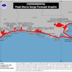
STORM SURGE:  The combination of a dangerous storm surge and the
tide will cause normally dry areas near the coast to be flooded by
rising waters moving inland from the shoreline.  The water could
reach the following heights above ground somewhere in the indicated
areas if the peak surge occurs at the time of high tide...

Johnson Bayou LA to Rockefeller Wildlife Refuge including Calcasieu
Lake...15-20 ft
Sea Rim State Park TX to Johnson Bayou LA including Sabine
Lake...10-15 ft
Rockefeller Wildlife Refuge to Intracoastal City LA...10-15 ft
Intracoastal City LA to Morgan City including Vermilion Bay...8-12
ft
Port Bolivar TX to Sea Rim State Park...6-9 ft
Morgan City LA to Mouth of the Mississippi River...4-7 ft
Freeport TX to Port Bolivar including Galveston Bay...2-4 ft
Mouth of the Mississippi River to Ocean Springs MS including Lake
Borgne...1-3 ft
Lake Pontchartrain and Lake Maurepas...1-3 ft

The deepest water will occur along the immediate coast near and to
the right of the landfall location, where the surge will be
accompanied by large and destructive waves.

Unsurvivable storm surge with large and destructive waves will cause
catastrophic damage from Sea Rim State Park, Texas, to Intracoastal
City, Louisiana, including Calcasieu and Sabine Lakes. This surge
could penetrate up to 40 miles inland from the immediate coastline,
and flood waters will not fully recede for several days after the
storm.

Surge-related flooding depends on the relative timing of the surge
and the tidal cycle, and can vary greatly over short distances.  For
information specific to your area, please see products issued by
your local National Weather Service forecast office.

WIND:  Hurricane conditions are expected in the hurricane warning
area tonight and Thursday morning, with catastrophic wind damage
expected where Laura's eyewall moves onshore.  Tropical storm
conditions are moving onshore along the coast of Louisiana within
the tropical storm warning area and are expected to spread northward
within the warning areas overnight.

Hurricane-force winds and damaging wind gusts are also expected to
spread well inland into portions of eastern Texas and western
Louisiana early Thursday.

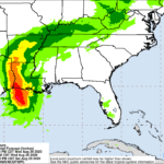
RAINFALL: Through Friday, Laura is expected to produce the following
rainfall totals:

Across the northwestern Gulf Coast from far southwest Louisiana and
the Golden Triangle of Southeast Texas: 8 to 12 inches with isolated
totals of 18 inches.

Across central and the rest of western Louisiana into far eastern
Texas: 5 to 10 inches with isolated totals of 15 inches.

Across much of Arkansas: 3 to 7 inches with isolated totals of 10
inches.

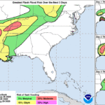
This rainfall will cause widespread flash and urban flooding, small
streams and creeks to overflow their banks, and minor to moderate
freshwater river flooding.

By Friday into Saturday, Laura is expected to produce the following
rainfall totals:

Across the mid-Mississippi and portions of the Tennessee Valley,
Lower Ohio Valley, and central Appalachians: 2 to 4 inches with
isolated maximum amounts of 6 inches.

This rainfall may lead to flash and urban flooding and rapid rises
on small streams.

Across the Mid-Atlantic Region: 1 to 3 inches.

TORNADOES:  Several tornadoes are expected tonight over Louisiana,
far southeast Texas, and southwestern Mississippi.  The risk for
tornadoes will continue on Thursday across Louisiana, Arkansas, and
western Mississippi.

SURF:  Swells produced by Laura are affecting the U.S. Gulf coast
from the west coast of Florida to Texas and northeastern Mexico.
These swells are likely to cause life-threatening surf and rip
current conditions.  Please consult products from your local
weather office.


